
Trace a Carson City Street by Address
Ownership, occupancy, and neighborhood geography are different questions. Carson City is a consolidated municipality and county-equivalent, so older material may be filed under Ormsby County while later material uses Carson City. An address search can return a parcel, a tax-year owner label, a recorded instrument, a permit record, or a dated directory entry. Each has a narrower meaning than a claim that someone lived there continuously. Normalize the number, street name, suffix, unit, city label, ZIP code, and any historical alias before beginning.
The best first pass is broad enough to catch a suffix or directional variation, but not so broad that neighboring results become an assumed match. Keep the full address string and the date of each search. The workflow below joins the official address routes without treating any one result as complete proof of a household.
- Use USPS ZIP Lookup to check the mailing combination by address or by city and state. Its result is postal guidance, not a municipal-boundary finding.
- Search Carson City Property Inquiry with the address number range and street name. The portal advises omitting a street suffix for a broader match.
- Record the parcel ID, situs address, owner label, sale date, sale price, and document number only when the result displays them. Compare the parcel in MapGeo before moving on.
- Carry the parcel or document number to Landmark Web, then test one Recorder search method at a time and inspect the instrument route.
- For a dated occupancy question, use an applicable directory, newspaper, or lawful Elections request as a separate source. Record the year and source wording rather than merging it into a current claim.
Note: A street result should be described by its record type and date, because the same address can appear differently in parcel, deed, directory, and election materials.
Normalize a Carson City Street Search
Carson City postal geography has practical edge cases. USPS may return a mailing ZIP that reaches nearby geography, and the Carson City Assessor's situs address is a physical property label rather than a mailing address. Run a street fragment with and without its suffix when Property Inquiry does not find the exact wording. If a directional prefix is present, test both forms and use the returned Carson City parcel map to decide which result fits.
For older Carson City research, also test Ormsby County. Carson City and Ormsby County consolidated on July 1, 1969. That change affects the jurisdiction label used in directories and instruments. It does not authorize rewriting an older source label. A missing hit can reflect spelling, a directory's central-city coverage, a missing volume, a protected record, or an online coverage break. Preserve the Carson City search terms and no-result reason for a later review.
Carson City Street Directory Property Fields
Property Inquiry is the starting point for the current address layer of a Carson City street directory. Its Parcel Search accepts a parcel ID, owner name, low and high address numbers, and street name. The separate Personal Property Search adds city and ZIP code, but a physical address is better checked through the parcel route. Advanced Parcel Search and Sales Search & Export add filters that can help distinguish similar street results without turning a classification field into an occupancy finding.
| Property Inquiry field | Search route | Street-work use |
|---|---|---|
| Address Number Low / High | Parcel Search | Sets a modest address range for a street pass. |
| Street Name | Parcel and Personal Property Search | Use a fragment; omit the suffix when testing a broader match. |
| Parcel ID | Parcel Search | Connects the address to maps, sales, and Recorder research. |
| Owner Name | Parcel Search | Provides an assessment label, not a verified occupant field. |
| Sale date, price, document number | Sales Search & Export | Creates a bridge to a dated recorded instrument. |
The assessment-roll page also supplies owner-alphabetized roll PDFs from 2017–18 through 2026–27. Those rolls are tax-year snapshots under NRS 361.300, with unsecured property excluded. Compare two roll years with a document and sale field instead of reading one line as a full property history.
The official Property Inquiry screen shows the parcel-search route used for a Carson City street directory search.
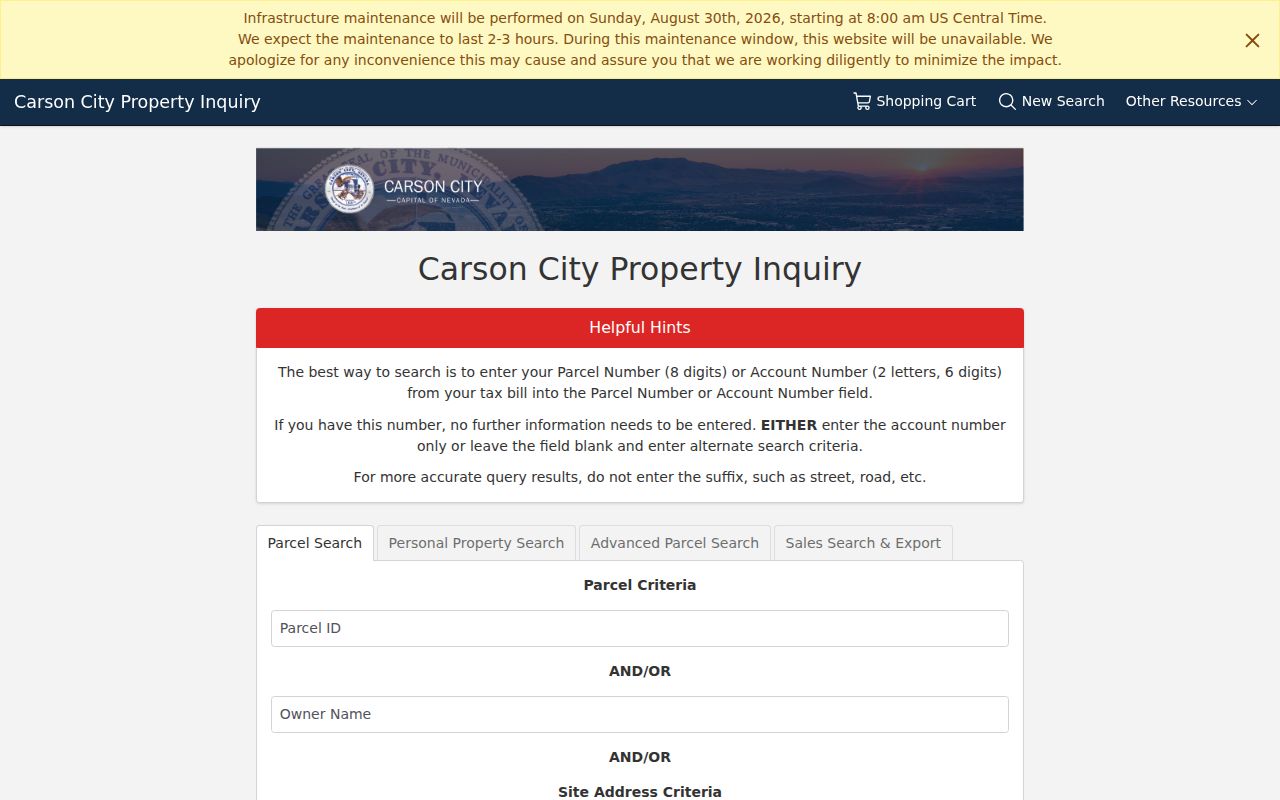
The fields shown here support address, owner, and parcel research. A returned owner label still needs a dated deed or other source before it is treated as evidence of a particular interest.
MapGeo Checks Carson City Street Parcels
Carson City MapGeo and the city's ArcGIS Open Data route help confirm parcel adjacency, road names, public facilities, and neighborhood context. The text inspection did not capture MapGeo's rendered address-search, identify, layer, print, or export controls. Treat those functions as a visual confirmation step, not as features that can be assumed from the landing screen.
A parcel boundary can show that properties touch or share a road. It cannot show a social, family, or other relationship between people connected to those parcels. Save the map URL, visible layer or dataset title, search date, scale, and parcel identifier when a map is used as evidence.
The MapGeo viewer is the official visual layer for this Carson City street directory workflow.
This landing view should be paired with a visible parcel result before it is used to confirm a street-level result.
- Parcel
- A numbered property unit used by the Assessor and map systems to locate a tract of land.
- Situs address
- The physical property location carried in assessment work; it may differ from a mailing address.
- Plat
- A recorded subdivision or parcel map that helps identify the legal layout behind an address.
- Criss-cross directory
- A reverse directory arranged by address rather than by a person's name, useful only for the date and coverage of its volume.
Carson City Records Searchable by Street
A Carson City street directory requires a record-by-record approach. The street name or parcel ID can connect several systems, but their results are not interchangeable. Property Inquiry is strongest for the parcel label and assessment facts. Landmark is stronger for recorded instruments. Elections has a controlled request route, and municipal records may need a focused public-record request. The table shows what each channel can and cannot establish.
| Address-keyed source | Custodian | Useful result | Access channel |
|---|---|---|---|
| Parcel and sales data | Carson City Assessor | Parcel, situs, assessment owner label, sale and document fields | Property Inquiry; assessment-roll PDFs; Assessor office |
| Parcel geography | Carson City map and data services | Parcel boundaries, roads, public geography | MapGeo and ArcGIS Open Data |
| Recorded instruments | Carson City Clerk-Recorder | Deed, release, legal-description, and index trail | Landmark index; Recorder request or counter route |
| Voter file or vote history | Carson City Elections | Legally available election record with statutory exceptions | Written request and advance payment |
| Permits, plans, and code records | Community Development or records custodian | Project and address history, subject to access rules | Department route or focused public-record request |
Carson City's public-record request process accepts requests by telephone, in person, mail, email, or fax when the description is reasonable. The Carson City response target is no later than the end of the fifth business day, although production can involve inspection, payment, or an availability date. State law and withholding rules still control the actual release.
Carson City Street Records Through Landmark
The Carson City Landmark Web index offers Name, Document, Book Page, Record Date Range, Instrument Number, and Legal Search modes. It also has a Quick Search selector. The Recorder's instructions say to search one method at a time. For an address trail, first capture the Property Inquiry parcel ID or sale document number, then try the corresponding Landmark route. For a name search, use last name, comma, space, first name and test spelling variants or initials.
APN input has its own syntax. The Recorder's search instructions show the APN number without hyphens or leading zeroes, using APN 763306 for 007-633-06. Book/page, record-date, document-number, and legal-description searches are useful cross-checks. Compare the parties, instrument date, legal description, document type, and parcel before drawing a conclusion from a match.
Landmark's online document boundary begins in 1962. Earlier instruments need the Clerk-Recorder's paper or staff route, with the Nevada State Archives as another source for material outside municipal holdings. The Recorder is at 885 E Musser St, Suite 1025/1028, and its phone is (775) 887-2260.
The Landmark Web index displays the distinct Recorder searches used after an address has supplied a parcel or document clue.
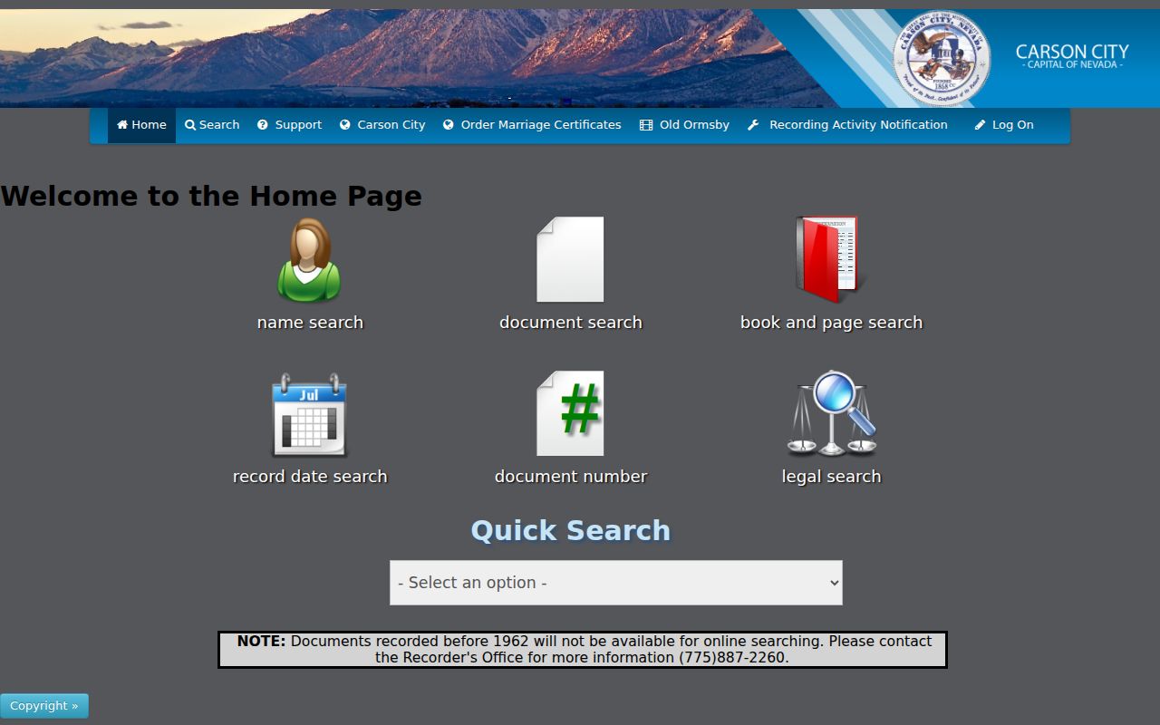
This index is a finding aid rather than the recorded instrument itself, so an image, paper record, or custodian response remains important for a precise deed question.
Note: An instrument listed under a name may be a trust, entity, release, or reconveyance, so confirm document type before describing ownership.
Carson City Street Permits and Planning
The Building Division requires project location and APN, legal owner or contact information, contractor or license information, a project narrative, costs, and sometimes soils documentation. Those categories provide useful request language for a property timeline. Ask for a bounded set of permits, plans, inspections, code cases, zoning or development applications, and recorded parcel maps tied to the exact address or APN and a date range.
Carson City Code Enforcement accepts written complaints, Carson City Connect, email, and drop-off. A complainant name and email are required for tracking, while the complaint is described as anonymous unless permission is given. A complaint is not a finding of violation. The 2026 pre-roof inspection change is a reminder that permit procedures change, so name the document category and dates instead of presuming a modern record set existed in every year.
Carson City Planning material can also supply a neighborhood label or assessment-area context. The city's South Carson, Downtown, and proposed East William Street Neighborhood Improvement District materials are planning and assessment records, not a street-by-street roster.
Carson City Street History Has Gaps
Street history in Carson City is uneven by period. A dated directory, deed, newspaper item, permit, and parcel map each prove different things. The research identified reverse-directory runs used in the official Brown Street report for 1970, 1975, 1976, 1980, 1985, 1990, 1995, 2000, 2005, 2010, 2014, and 2018, but the report cautions about central-city and developed-area limits. An absent entry should not become a statement that nobody was there.
The 1969 consolidation explains why older material often requires the Ormsby County name. Earlier still, the August 18, 1865 fire destroyed a block between Carson/Fall and Fourth/Fifth Streets. For that block, newspaper notices, directory changes, deeds, and parcel maps can help reconstruct a location sequence. They should be kept as dated layers, not compressed into a continuous occupancy story.
For a historical volume or past address clue, the local collection details belong with the Carson City city directory research rather than a modern parcel result.
When a Carson City Street Search Stops
When an online search fails, narrow the question instead of widening it to every Carson City record. Keep the parcel or account number, instrument number, exact indexed name, approximate dates, and record class. Then ask the Carson City Clerk-Recorder whether an original volume, image copy, certified-copy route, or referral is available. Historical originals are held at 885 E Musser St, Suite 1028; the genealogy-material phone is (775) 887-2084. The Nevada State Archives at 100 N Stewart St also has an Ask an Archivist route for state-level material.
A focused request can ask for the index or electronic records for permits, inspections, code cases, zoning or development applications, and recorded parcel maps connected to one address or APN. Ask the custodian to identify withheld records and the legal basis. That preserves the difference between an unavailable online hit and a confirmed absence.
Limits of a Carson City Street Directory
A Carson City street directory can connect public, address-keyed records, but it cannot establish a complete household, a current resident list, or continuous occupancy. Assessor data is a tax-administration snapshot. A deed records an instrument, not necessarily a current address. A directory is tied to its year and coverage. Election records have separate statutory limits, including address and telephone withholding, while court sealing, vital-record rules, protected DMV data, and the Nevada Confidential Address Program create other limits.
Use the official source title, date, and custodian route. Describe a result as indexed, filed, returned, or verified according to what the source actually did. Do not copy protected addresses, IDs, full dates of birth, signatures, payment information, or health information into notes.
Lawful use. Address records are for lawful personal research and civic transparency. Do not use them to stalk, harass, intimidate, or harm anyone; Nevada protections can limit what a custodian releases.